The village of Hochmoor
The village of Hochmoor - it all started with peat
The natural space of the "White Fens" is located on the edge of the Westphalian bay and reaches up to Gescher and its neighbouring towns of Coesfeld, Reken and Velen.
The moorland originally covered an area of around 1,200 hectars and used to be the largest in Westphalia at the end of the 19th century. The source of the little stream “Heubach” and the extensive surrounding wetland meadows were part of it.
The "White Fens" were hard to access until the middle of the 19th century. When first mapped, they were marked as "no land". The fens’ black and white peat had an enormous thickness of two to five metres.
The name "White Fens" is probably derived from the white-flowering cotton grass that covered large areas of the raised bog.
Initially, peat was only extracted on a small scale at the edge of these moor areas. It was very difficult and took until 1846 to establish a settlement in the so-called Tungerloh Mark.
Things changed when the Fens were partly cultivated and the Klasmann peat works were founded between 1906 and 1908. The first settlements were established in 1909 not far from the works and in 1912, a single-class school was built. This laid the foundation for today’s Hochmoor community. It took a long time to agree on a name for the village. The name Hochmoor was officially designated in 1962.
Industrial peat extraction only lasted for about 50 years and ended shortly after the great moor fire in 1959. Towards the end of peat extraction and following various cultivation and infrastructure measures, the former Fens were transformed into extensive agricultural areas operated by numerous small farms. This, of course, changed the landscape significantly in many areas. The residential and commercial areas of Hochmoor were continuously developed along with it.

Wollgrasblüte um 1920
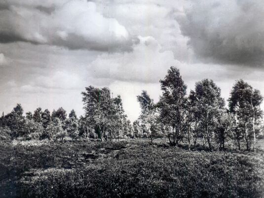
Typische Moorlandschaft

Torfstich in Handarbeit
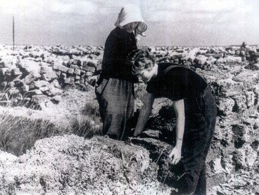
Trocknungslagerung
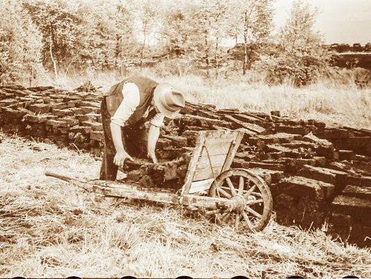
Beschwerlicher Abtransport

Torfwerk um 1910

Arbeitersiedlung Klasmannstraße

Die erste Schule 1912

Kultivierung im Moor

Maschineller Torfabbau

Erste Läden entstehen ab 1933

Landwirtschaft im ehem. Moor
Hochmoor – 100 years and more
The raised bog formed approximately four to five thousand years ago.
1846 Henrich Hermann Höbing, a peasant, is the first person to officially settle in the area.
A small amount of private peat cutting is already done on the edge of the raised bog area.
1906-1908 Start of industrial peat cutting by the Klasmann company on land belonging to the House of Landsberg-Velen and Gemen
From 1907 Construction of a railway link (Vennebähnken) between the peat works and Velen railway station and the Empel - Coesfeld railway line
From 1909 Construction of the first workers' housing estate for German and Dutch peat-workers and their families on Klasmannstrasse
1912 A one-class primary school is opened and Hochmoor becomes an independent school community
Birth of the village of Hochmoor
1917 Numerous prisoners of war are employed in peat cutting after the Dutch families have returned home during the World War.
1918/19 The peat works continue to evolve. Water and electricity works are built to supply the factory and settlement.
From 1925 A second workers' settlement (called the new colony) is built in Stephanusstrasse to house the new citizens who had been expelled from the former German eastern territories.
1929 New building of the peat factory after a major fire in 1928
1931 Sale of the count's moorland property to a settlement company, which later operates under the name Red Earth.
1935/36 First solid road connection to Velen and the "Gabelpunkt" crossing. Construction of the central "Pappelallee" road. Start of large-scale cultivation and drainage work in “White Fens”.
1940 A dummy airport is built in the moorland.
140 prisoners of war have to do forced labour in peat extraction.
1942 The "Fürstenkuhle" landscape area is placed under nature conservation due of its special flora and fauna and its original moorland landscape.
1947 Extensive cultivation work and land parcelling in the area of the former peat fields. The landscape of the White Fens changes dramatically. The company Pharma GmbH settles in Hochmoor and creates jobs for former soldiers and Germans expelled from the east.
From 1950 Small farms are set up. Hochmoor has a restaurant, bakery, post office and carpentry workshop.
1959 Large-scale peat bog fire occurs in the hot summer months. Peat cutting slowly comes to an end. The company Trapo AG (formerly Karl Stumpf) moves to Hochmoor.
1960 A new primary school on Pappelallee replaces the old school.
1961 More residential building in area south of Pappelallee.
1962 The history society is founded.
The village receives its official name of "Hochmoor".
1966 A simple transitional church (today's parsonage) is built in Landsbergstrasse.
1967 The veterinary clinic moves to the industrial estate.
1972 The Protestant parish hall is built.
1976 The new Catholic church of St. Stephen is consecrated.
1979 Hochmoor wins the Best Village competition.
1998 The primary school is enlarged and receives an assembly hall, also used as village hall.
2002 The Catholic parish becomes part of the wider pastoral area of Velen and Ramsdorf.
2010 A memorial is erected commemorating the large number of forced labourers during World War II.
2012 Hochmoor celebrates its 100th anniversary in its "Green Centre".
2020 Around 2,000 citizens live in Hochmoor.

Vennebähnken

Optantensiedlung 1925 – 1960
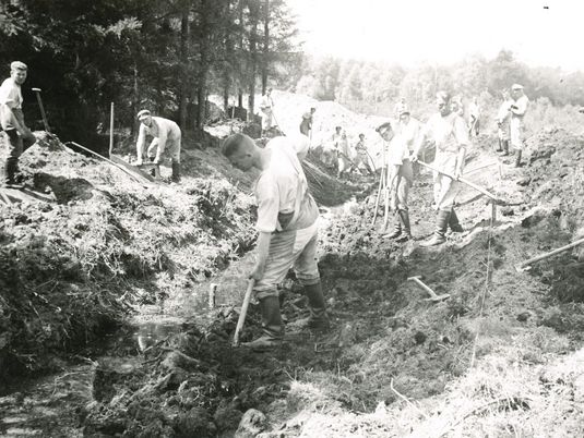
Moorentwässerung 1935

Tiefpflüge im Einsatz

Moorbrand 1959
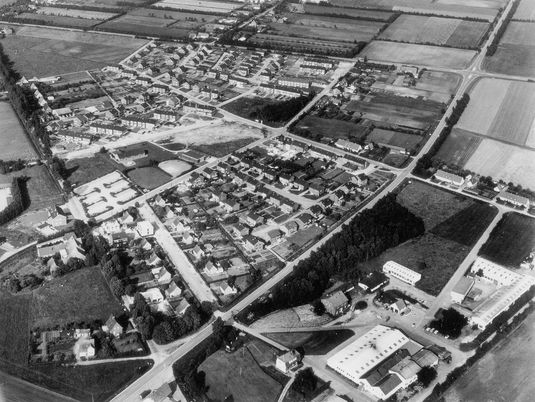
Die Siedlung wächst 1967
White Fens
„White Fens“ and Heubach meadows undergoing fresh changes
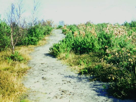
The first nature reserve in the region to be placed under special protection was the Fuerstenkuhle area in 1942. Thus the characteristics of a typical moorland landscape could be preserved.
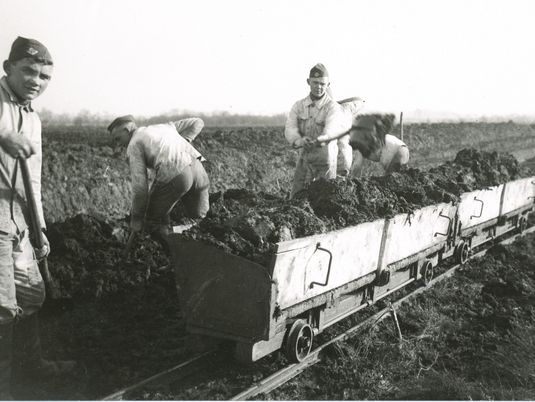
Large parts of what used to be the largest moorland area in Muensterland were transformed in the years following into intensively farmed, agricultural areas, which had required extensive drainage and cultivation work. It was not until the end of the 20th century that private efforts as well as initiatives by the nature conservation authorities, supported by public funding measures, led to closer collaboration between nature conservationists and farmers so that step by step some of the natural area worthy of protection could be recovered.
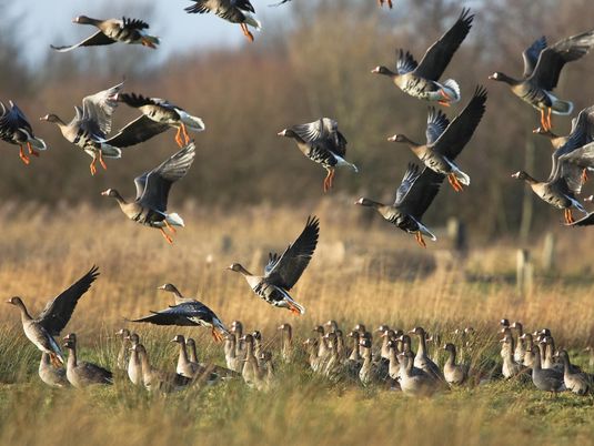
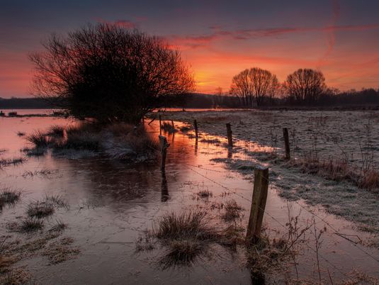
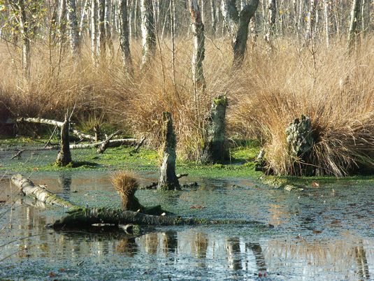
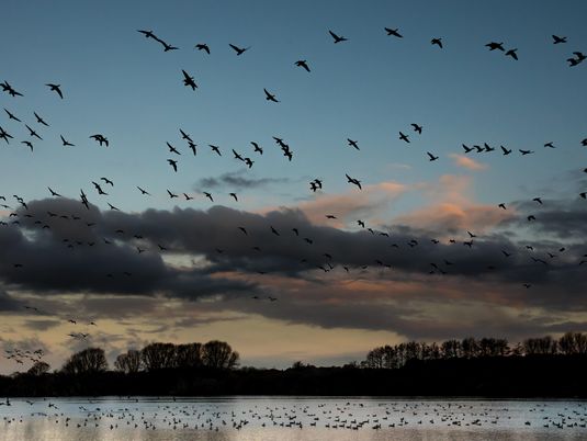
These efforts have increased significantly in recent years. Further areas of the "White Fens" and Heubach lowlands east of the village of Hochmoor have been placed under nature and landscape protection. Besides Fuerstenkuhle, the Kuhlenvenn nature reserve has become a special attraction for nature lovers since 1988. Numerous wet meadows interspersed with small lakes, reedbeds and shoreland offer ever-changing views of this versatile natural area.
Why not take a look for yourself, especially at the great variety of water birds, waders and meadow birds which breed or rest in this natural space? It is a great year-round nature experience for young and old. Clearly, large parts of the "White Fens" are again undergoing positive changes.
You are invited to turn to the Biological Station in Zwillbrock (www.bszwillbrock.de), the district of Borken, Department of Nature and Environment (info@kreis-borken.de) or the local heritage association in Hochmoor (www.heimatverein.in-hochmoor.de) to learn more of this nature reserve.
The qualified staff at these places will be happy to provide you with further information.
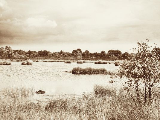
Landschaft im Weißen Venn um 1900

Moor- und Heidelandschaft
Heideweg
Kultivierung in den 1930er Jahren
Wiedervernässung
Zugvögel im Kuhlenvenn

In der Fürstenkuhle

Impressionen aus Kuhlenvenn und Fürstenkuhle

