Haus Hall from 1943 to 1945
Haus Hall from 1943 to 1945 - auxiliary hospital, maternity home and military hospital
Haus Hall provided a home for people with special needs and for children and young people needing care. In 1944 and 1945, however, it faced entirely new tasks when it was turned into an auxiliary hospital for the Emscher-Lippe district. As such, it also had a maternity ward. Haus Hall had been chosen for this as it was in a rural setting away from metropolitan areas.
More than 600 births were registered here in 1944 alone. In contrast, most of the patients also cared for in Haus Hall were old and infirm and many of them died.
An entirely new challenge arose early in 1945. Due to the changed situation at the western front, the German army was retreating and more hospital beds were needed in the Westphalian region. Haus Hall was therefore turned into a military hospital and the maternity ward and sick people had to be transferred to other hospitals.
Around 1,000 new patients were admitted at the end of March 1945, following warfare west of River Rhine, but also due to air raids on the neighbouring towns of Coesfeld, Dülmen, Borken and Stadtlohn. Up to 1,300 people were cared for at Haus Hall. The military hospital in Haus Hall was closed down at the end of 1945.
The military cemetery, today a war grave memorial
Soldiers who died in the military hospital were buried on a separate graveyard, situated on a small hill next to the Berkel. Around 120 people found their final resting place there. They had come from all over Germany. In later years, some of them were moved to their hometowns at the request of their relatives.
In the 1960s, eleven Soviet prisoners of war and forced labourers who had died in Hochmoor and been buried elsewhere were also transferred to the military cemetery. It was not until 2014 that seven of them could be identified and their names be engraved on a specially created sandstone plaque.
Originally, simple wooden crosses had been erected on this graveyard, sometimes with the soldiers’ steel helmets. They have been replaced by uniformly manufactured sandstone crosses, with the names of the soldiers engraved on them and surrounded by simple plants.
The Haus Hall Foundation has taken care of and maintained the graves in close collaboration with the National Association of German War Graves Commission and the town of Gescher since the end of World War II.
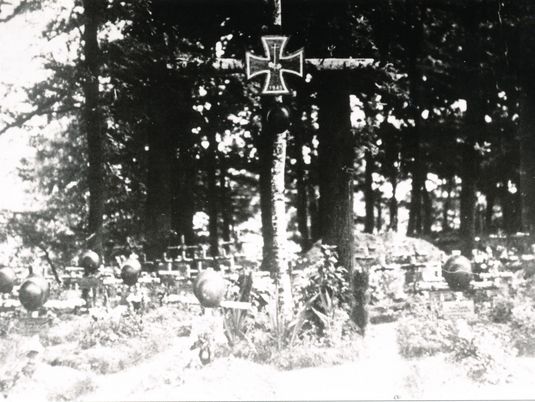
Gräberfeld am Ende des Krieges

Haus Hall zur Lazarettzeit
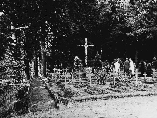
Erste Umgestaltung in den 1950ern
The Berkel floodplain in transition &
The Berkel floodplain in transition - flood protection measures change the landscape
The Berkel floodplain has undergone major changes over the last one hundred years, especially from the 1960s onwards. Originally, the Berkel meandered largely unhindered through the outskirts of town. This changed significantly when building activities increased in connection with the urban development. The river was straightened in parts and lateral flooding zones disappeared.
When soil sealing increased both in the built-up area of town and its surroundings, flood protection measures had to be improved. These measures were mainly rainwater retention, sometimes combined with rainwater clarification basins, or enlarged floodplains in the vicinity of the Berkel and its feeder brooks.
Former agricultural areas close to the river banks were converted into flood plains, which often required lengthy land consolidation procedures. The land consolidation authority of the regional government provided intensive support and technical assistance for this.
These measures have clearly enhanced the natural environment of the Berkel floodplain, with its flora and fauna benefitting as well. During floods, most recently in June 2016, the temporarily flooded dips provide important protection for humans and animals as well as buildings and infrastructure facilities. This is impressively demonstrated by the floodplain between Haus Hall and Holtwicker Damm. The newly created grassland area is now considered a popular local recreation area. The new foot and cycle path, which was relocated from the banks of Berkel to the east, provides a view of the floodplain landscape which is constantly changing throughout the year, has great biodiversity and high ecological potential.
The same applies to many other flood protection measures implemented on the edge of new settlement areas in recent decades. The greatest role plays the Berkel river with its shallow waters and, in some places, steep banks.
The floodplain area, which has been largely placed under nature and landscape protection, continues to undergo gradual change in Gescher and in the neighbouring German and Dutch towns so that permanent flood protection in compliance with the European water protection directives and nature conservation regulations can be ensured.
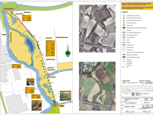
Renaturierungsplan der Berkelaue

Berkel im Normalzustand
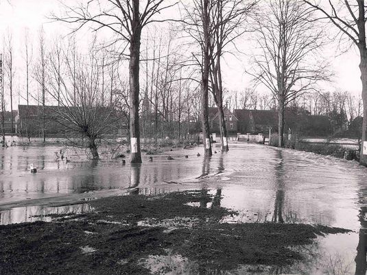
Hochwasserereignisse…

…an der Hambrücke und...
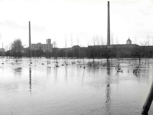
…in den Berkelwiesen
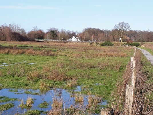
Berkelwiesen als Rückhalteraum

Berkelspaziergang – im Trockenen
The Farming Communities and Countryside around Gescher &
The Farming Communities and Countryside around Gescher
Gescher as a whole covers roughly 80 square kilometres, 8 percent of which is urban space and 92 percent belongs to the surrounding countryside or “outer area” with its farming communities. Most of the outdoor area (87%) consists of intensively farmed fields and meadows as well as farms of various sizes.Woodland makes up for only 13% of the outer area. Water areas are also limited and mainly formed by the Berkel river and the small watercourses flowing into it. Ponds and small lakes, e.g. in Hochmoor, are quite rare.About 2,470 people live in these farming communities, which is about 14% of the total population (as of the end of 2019).
Currently, there are 85 farms, 72% of which are full-time farms, while the others are managed part-time. Farming is undergoing structural change and most farmers grow maize, cereals and intermediate crops such as rape and mustard.
There is mostly pig and cattle fattening on the farms. Horse husbandry and horse breeding play an increasingly important role around Gescher as it is part of the equestrian Muensterland region.
Agriculture in Gescher loses several hectares of land every year due to housing and commercial development as well as infrastructure measures such as road and path construction. As a consequence, soil sealing is increasing and new flood protection measures have to be taken. Such measures often require a lot of land, which may contribute further to the reduction in agricultural land.
Good-bye!
Dear Visitor,
You have now arrived at the final station of the Gescher History Trail. We hope you have enjoyed the circular route and learnt a lot about our town and, especially, about its people and events. To return to the starting point, go just 500 metres along the road to Hallerweg. In Hochmoor, which is about 7 km to the south, there is an additional station in its “Green Centre”.
We wish you a pleasant day and look forward to seeing you again in Gescher. You are also welcome to visit our website at www.zeitundraum.de.
The team of Time & Space (“Zeit und Raum e.V.”) in Gescher

Frühe Motorisierung

Pause nach getaner Arbeit

Unterstützung durch Pferdestärke
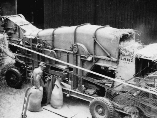
Drescher der ersten Stunde
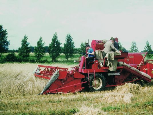
Einer der ersten Mähdrescher

Mähdrescher heute
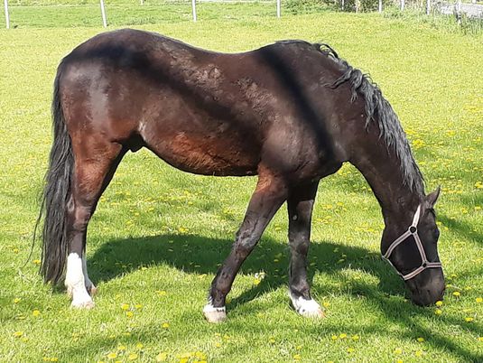
Pferderegion Münsterland